
Delivering High-Precision Geospatial Data Processing & Engineering Services Worldwide.Your Trusted Partner for GIS Vectorization, Point-Cloud Processing, BIM Modeling & Desktop Inspection Services.
Delivering GIS mapping, LiDAR processing, BIM modeling, CAD services, digital twin solutions, and engineering data management through a unified workflow.
Collaborate with our multidisciplinary team of GIS Engineers, LiDAR Specialists, Urban Planners, Architects, and CAD Professionals to align project objectives, schedules, and deliverables for efficient and successful execution.
Apex provides expert GIS, BIM, LiDAR, and Desktop Annotation and Inspection services that support infrastructure development, asset management, and digital engineering transformation for projects worldwide.
Georeferencing, Geocoding, 2D & 3D Vectorization, Digitization and Conversion of Legacy Data, Manual Quality Control, and Creation of Consistent Datasets
Expertise in processing LiDAR data from airborne, terrestrial, and mobile mapping systems, and integrating survey data and imagery to improve positional accuracy
BIM Modeling Services for infrastructure, utility networks, scan-to-BIM workflows, and architectural projects through the integration of CAD, BIM, and reality capture data
GIS Documentation, Digitization, Vectorization, and Georeferencing of Utility and Infrastructure Networks, including Electricity, Water, Gas, and Telekom..
Harnessing LiDAR, imagery, CAD, and mobile mapping data to deliver accurate GIS products, 3D models, and high-definition mapping for transportation systems..
Geospatial annotation services for AI and machine learning, delivering precise training datasets through imagery, LiDAR, and spatial data labeling.
Infrastructure inspection and annotation services that evaluate asset health, track performance, and structured data for maintenance, compliance, and decision-making.
Comprehensive GIS and geospatial solutions for land and environmental management, enabling informed decisions across natural and built environments.
Apex addresses diverse industry challenges by delivering tailored geospatial engineering and digital solutions across global sectors
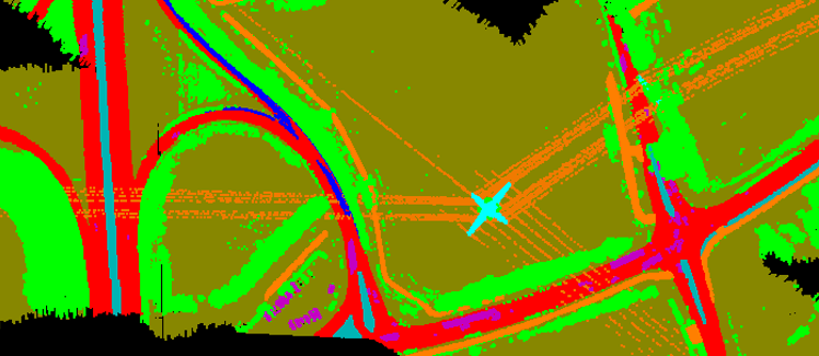
Advanced geospatial engineering enabling network mapping, asset intelligence, and modernization of critical infrastructure systems.
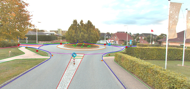
Apex transforms mobile and aerial LiDAR and imagery datasets into precise 2D and 3D geospatial information.
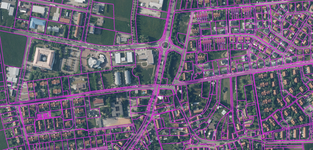
Spatial analytics supporting environmental monitoring, sustainable planning, and regulatory compliance for infrastructure and land management projects.
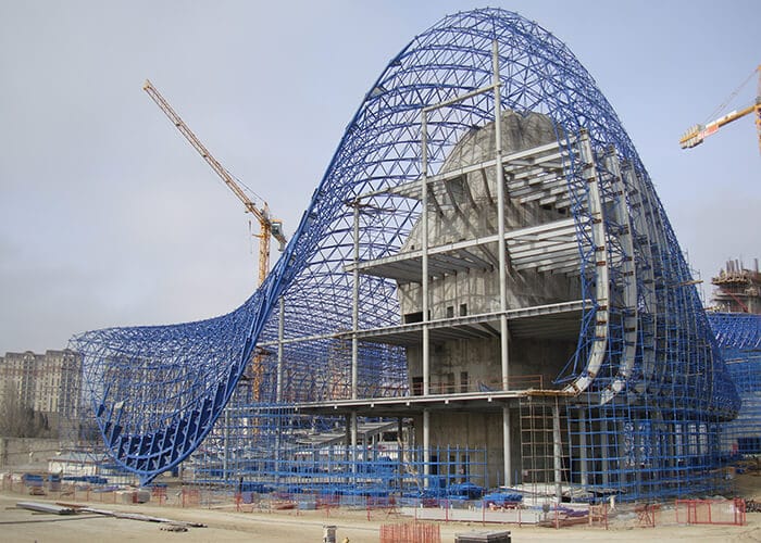
GeoBIM engineering workflows for planning, design coordination, and execution of infrastructure projects.
Apex deliver advanced geospatial engineering, digital modeling, and spatial intelligence execute complex infrastructure projects across transportation, utilities, and environmental sectors.
End-to-end conversion and organization of electricity, water, and gas infrastructure into structured spatial datasets
Derivation of road and transport features from large-scale mobile LiDAR data to support mobility and analytics initiatives.
Creation of BIM-compatible digital models for infrastructure assets to support city development and planning programs.
Preparation of CAD-based infrastructure drawings and layouts supporting urban design and planning processes
Apex delivers advanced geospatial engineering solutions by integrating GIS, BIM, LiDAR, and AI-driven workflows. We enable precise planning, optimized infrastructure lifecycle management, and accelerated digital transformation.
Our hybrid delivery model combines strong engineering expertise with scalable global execution, ensuring technical excellence and cost-efficient outcomes.
Years of industry involvement demonstrate ourdedication to precision, adaptability and maintain consistent competitiveness
Supporting infrastructure and environmental projects through complete geospatial and data processing solutions across transport networks, utility systems, renewable energy, land resources, and environmental initiatives.
Combining GIS, BIM, LiDAR, and AI-driven technologies to deliver precise geospatial intelligence for modern infrastructure and digital asset management.
Apex integrates engineering knowledge with advanced geospatial tools and a global delivery framework to support complex infrastructure projects, ensuring accurate data, faster execution, and smooth client integration.
Apex brings together engineering knowledge, modern geospatial technologies, and scalable delivery capabilities to handle complex infrastructure projects. Our process-driven approach ensures reliable data quality, efficient project timing, and effortless integration into client environments.
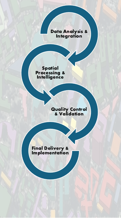
Let’s explore how we approach complex project requirements
Apex delivers specialized GIS, BIM, LiDAR, and GeoAI solutions enabling engineering projects globally with stronger planning, effective asset management, and digital transformation.
Aggregation of diverse spatial datasets including LiDAR, imagery, CAD, and field-collected survey data
Transforming raw spatial datasets into engineering-grade intelligence through advanced GIS, LiDAR, and BIM workflows
Maintaining high-precision results through staged validation processes aligned with global engineering standards
Preparing structured datasets for implementation across client GIS platforms, BIM solutions, and infrastructure systems
Collaborate with Apex to speed up infrastructure planning, enhance digital engineering workflows, and optimize asset lifecycle management.
National Utility Network Digitization