Apex provides professional road asset mapping services and GIS-based transportation infrastructure mapping for highways, urban roads, and rail corridors. We process high-resolution LiDAR, aerial imagery, CAD, and mobile mapping data to produce precise digital inventories of road networks and transport assets.
Our transportation infrastructure mapping workflows deliver structured geospatial outputs from 2D vector datasets to full 3D feature extraction supporting infrastructure planning, asset lifecycle management, and smart mobility data services.
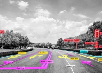
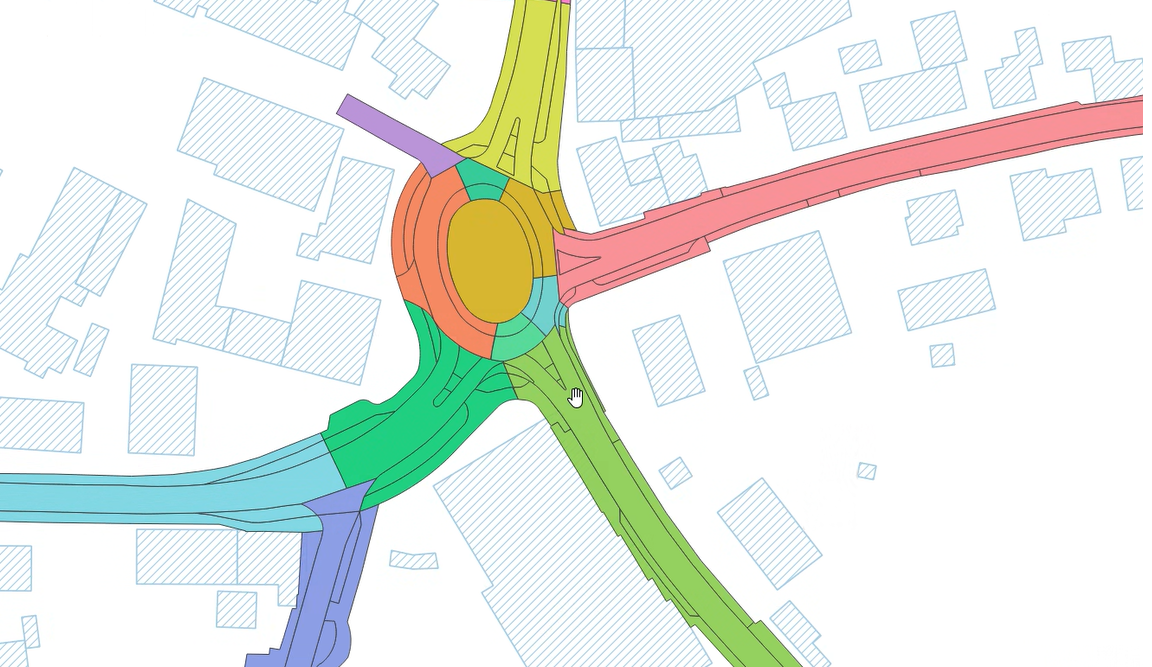
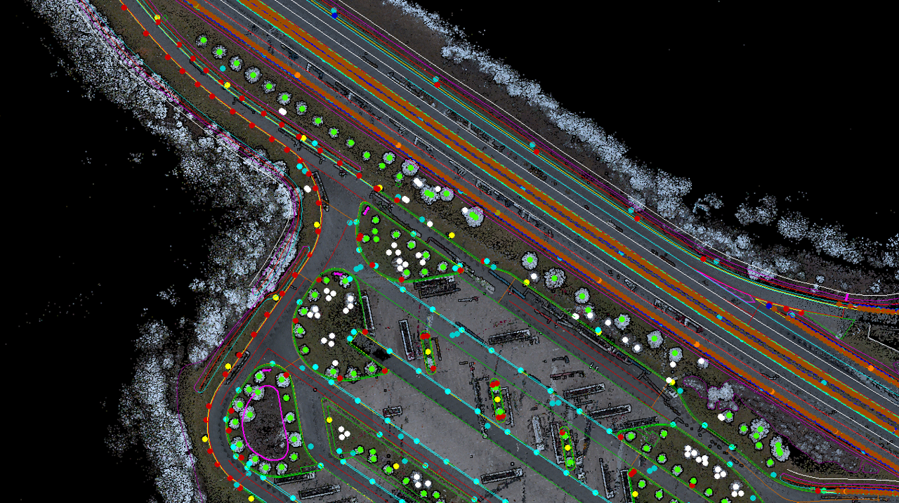
Our 2D and 3D feature extraction services transform complex road and urban environments into structured, GIS-compatible vector datasets. Using orthophotos, UAV data, panoramic imagery, and LiDAR road mapping inputs, we produce precise geospatial layers aligned to your coordinate system and classification standards.
Extracted features are attributed with material classification, spatial accuracy metadata, and maintenance codes — making outputs immediately usable in ArcGIS, QGIS, and other GIS road mapping platforms.
Typical Inputs:
Orthophotos, panoramic imagery, UAV data, GIS network data, aerial imagery, survey information, and related datasets
Typical Outputs:
GIS-ready vector datasets (shapefiles/geodatabases) containing classified 2D features with associated attributes
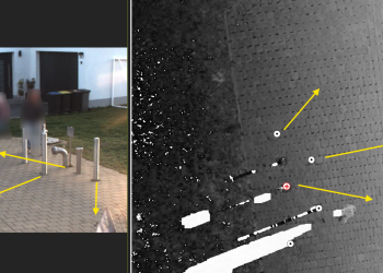
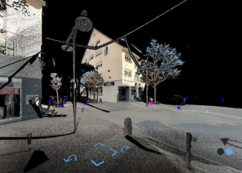
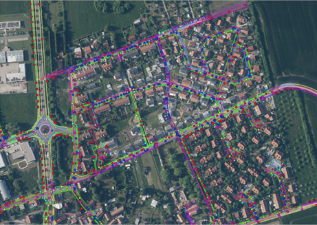
We capture and digitize detailed street-level objects in both 2D and 3D across urban and roadway corridors. Our services transform real-world infrastructure into structured GIS-compatible datasets using aerial, LiDAR and mobile mapping data, including the extraction of asset attributes, spatial relationships, and validation of feature locations and classifications.
The resulting datasets support asset management, infrastructure planning, digital twin initiatives, and 3D city modeling applications.
Typical Inputs:
Imagery sources, LiDAR datasets, survey records, existing asset data
Typical Outputs:
GIS-based inventories, attributed infrastructure datasets
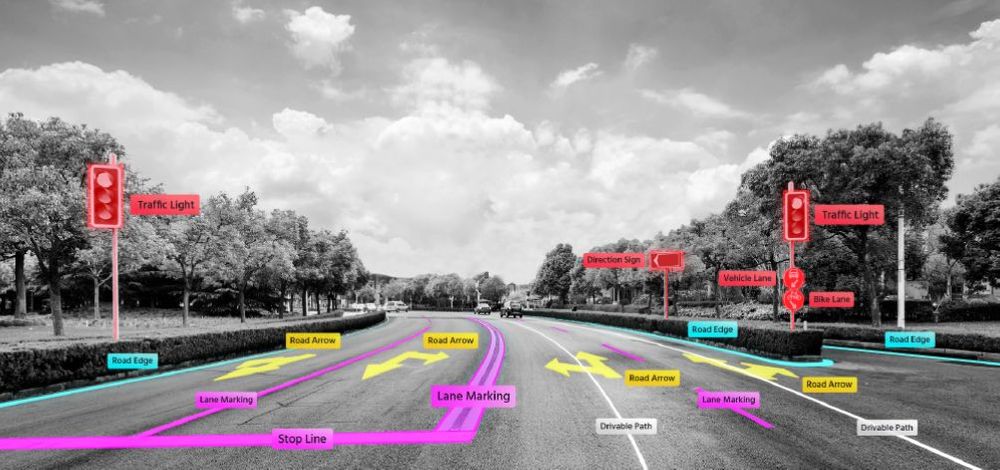
We provide complete traffic sign inventory management services, including 2D/3D detection, classification, and annotation of all regulatory, warning, and informational signage. Our workflows apply country-specific coding standards including German StVO (over 1,000 sign categories) ensuring compliance-ready GIS datasets
The resulting datasets support transportation authorities, municipalities, navigation platforms, maintenance operations, and digital twin initiatives.
Typical Inputs:
High-resolution imagery, LiDAR data, mobile mapping data
Typical Outputs:
Vector feature layers, structured GIS datasets, annotated road features
Our desktop-based road condition assessment service evaluates pavement surfaces, roadside assets, and drainage infrastructure using geospatial imagery and digital survey data. We identify surface defects, structural deterioration, safety hazards, and environmental encroachments with AI-assisted detection followed by expert manual validation for high-confidence, maintenance-ready outputs.
This service directly supports pavement condition monitoring programs, road maintenance prioritization, and compliance auditing for transport authorities.
Typical Inputs:
Street-level imagery, mobile mapping datasets, aerial photographs, point cloud data, and GIS/CAD information
Typical Outputs:
Condition assessment reports, defect inventories, GIS-compatible layers, prioritized maintenance datasets, and validated inspection results
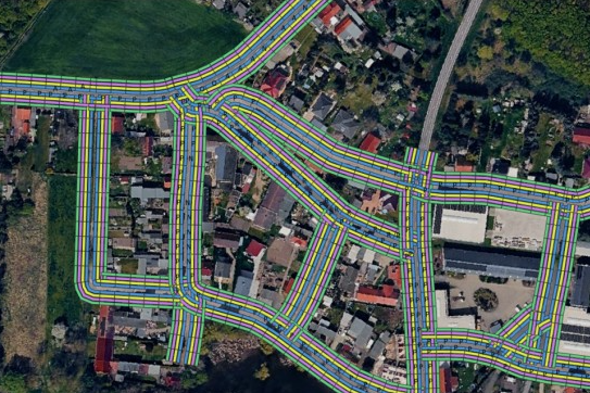
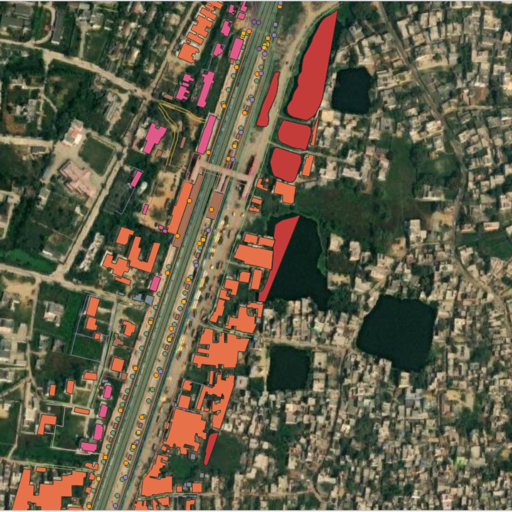
We deliver comprehensive highway asset management GIS solutions, converting motorway, expressway, and tunnel corridors into structured digital asset inventories.
Our 2D/3D mapping captures precise locations, classifications, attribute data, and spatial relationships for all highway infrastructure elements supporting long-term transportation infrastructure mapping, safety compliance, and digital twin transportation integration.
Typical Inputs:
Mobile Mapping datasets, tunnel survey information, point cloud data, imagery, and GIS/CAD datasets
Typical Outputs:
Structured GIS layers and 3D asset models containing classified highway and tunnel infrastructure data in Shapefile, Geodatabase, CAD, and 3D formats
Typical Inputs:
Mobile mapping datasets, aerial imagery, point cloud data, survey information, and GIS/CAD datasets
Typical Outputs:
Structured GIS layers and 3D asset models containing classified railway infrastructure data in Shapefile, Geodatabase, CAD, and 3D formats