Apex delivers end-to-end LiDAR data processing services that convert raw point cloud data captured via airborne LiDAR survey, mobile laser scanning, or terrestrial systems into precision-grade spatial datasets.
Our Germany-led quality framework ensures engineering-grade accuracy across transport corridor mapping, utility network documentation, terrain analysis, and digital twin development for complex infrastructure environments.
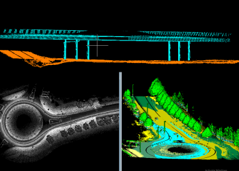
We process raw LiDAR point clouds from airborne LiDAR survey systems, mobile laser scanning (MLS) platforms, and terrestrial LiDAR scanners (TLS) into structured, analysis-ready datasets. Our processing pipeline guarantees point cloud accuracy at every stage from raw ingest to final validation serving geospatial and engineering teams worldwide.
Typical Inputs:
Raw point clouds (LAS/LAZ), trajectory files, GNSS/IMU data, imagery
Typical Outputs:
Processed and classified point clouds, aligned datasets, and validation reports
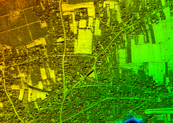
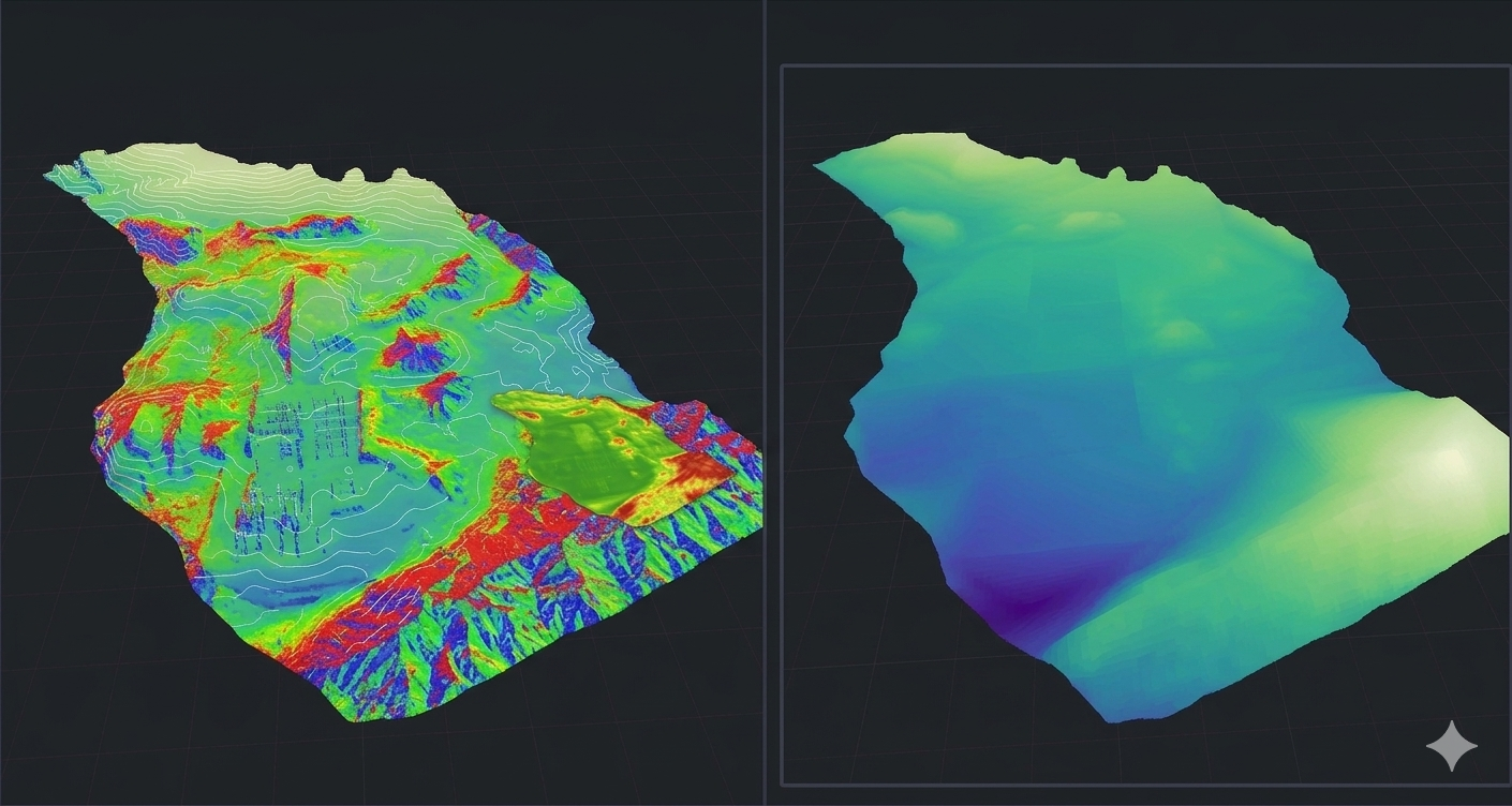
Our terrain modelling services transform classified LiDAR point clouds into high-resolution Digital Elevation Models (DEM), Digital Terrain Models (DTM), and Digital Surface Models (DSM). These outputs underpin flood risk modelling, infrastructure corridor planning, and engineering design across civil and environmental projects.
Typical Inputs:
Processed point clouds, ground-class data, elevation survey inputs.
Typical Outputs:
DEM, DTM, DSM, contour datasets, terrain analysis outputs.
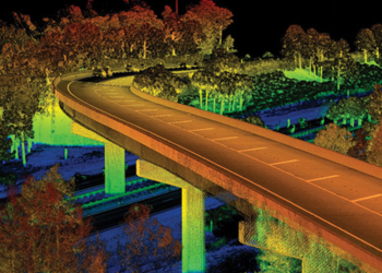
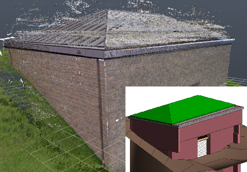
We convert LiDAR point clouds into detailed 3D models for buildings, transport infrastructure, and complex urban environments. Our outputs support digital twin development, BIM integration, and as-built documentation enabling infrastructure owners to plan, design, and manage assets with high spatial confidence.
Typical Inputs:
Point cloud datasets, CAD files, BIM models (IFC), imagery
Typical Outputs:
3D models, mesh outputs, BIM-compatible models, and visualization datasets
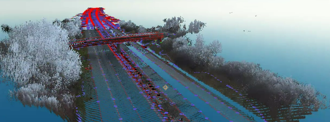
Our LiDAR feature extraction services derive accurate vector datasets from fused LiDAR and imagery sources.
We extract, classify, and structure spatial features at scale producing GIS-ready geospatial datasets that feed directly into asset management systems, planning tools, and engineering platforms.
Typical Inputs:
Point clouds, orthophotos, imagery, and available GIS/CAD datasets
Typical Outputs:
Vector layers (points, lines, polygons), GIS datasets, asset inventories
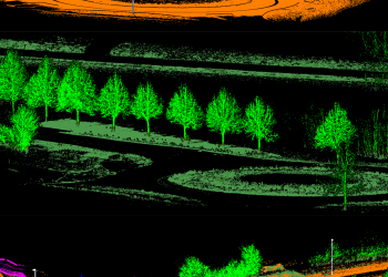
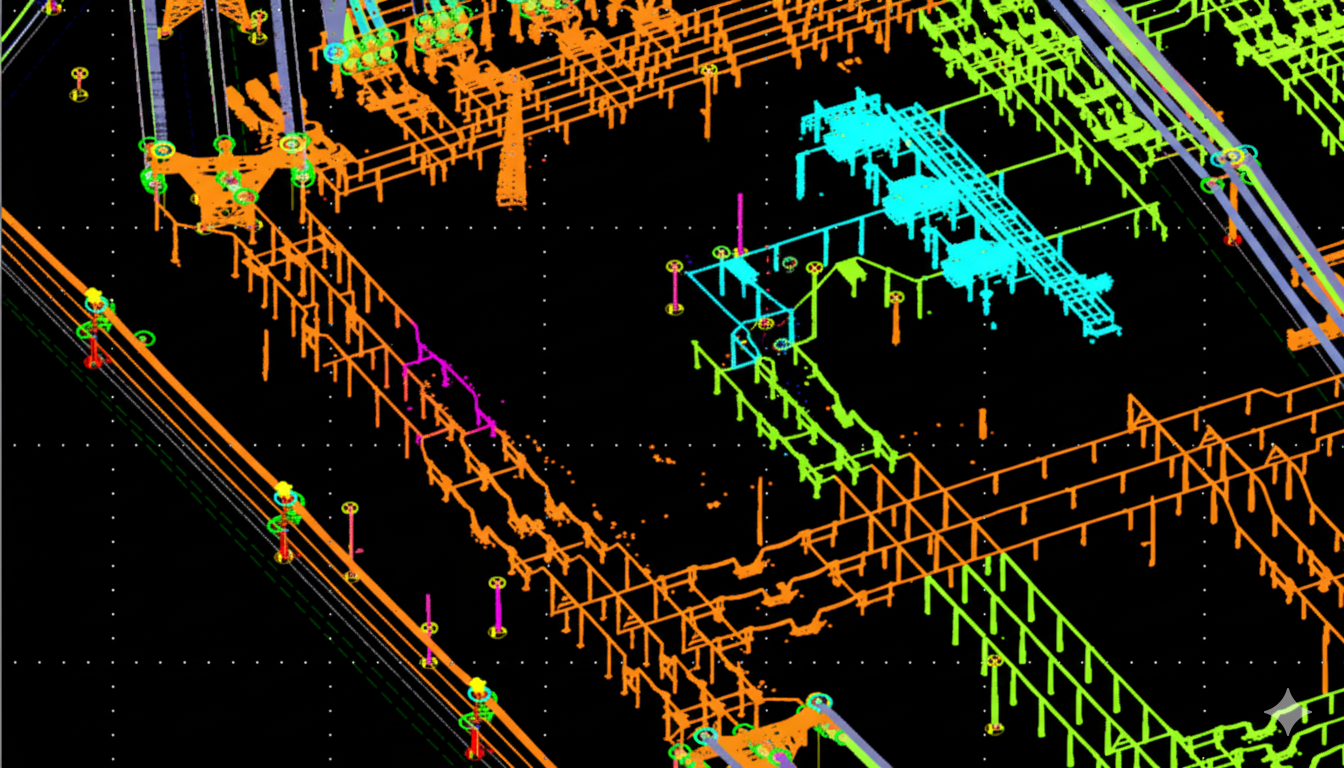
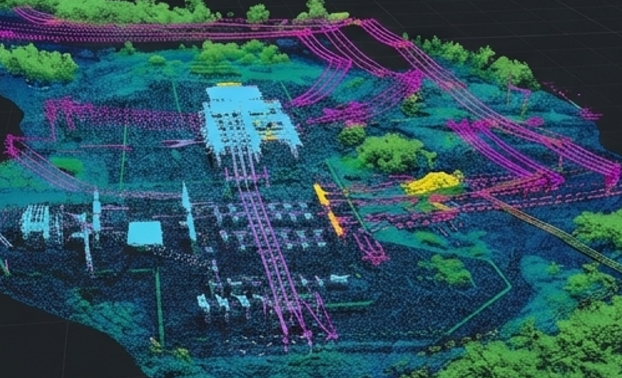
Our advanced LiDAR classification services handle the most complex point cloud environments from dense urban canopies to high-voltage power line corridor mapping.
We apply semantic classification to deliver structured, asset-grade data for utilities, forestry, and industrial infrastructure management.
Typical Inputs:
MLS point clouds, aerial LiDAR data, imagery, and utility datasets
Typical Outputs:
Classified point cloud datasets, 3D asset models, network representations, and BIM-ready data