Apex Etech converts raw location data into accurate, enterprise-ready geospatial intelligence, precision GIS data processing, offshore cost efficiency, German-led quality control.
Apex provides comprehensive GIS data conversion services and multi-source GIS data integrations transforming raw spatial inputs into structured geospatial databases. This also includes tasks such as GIS data updates, GIS data standardization, Metadata management, geospatial change detection, asset level updates, Parcel and Land records updates etc.
This helps GIS infrastructure planning, utility asset lifecycle management, geospatial digital twin development, and spatial data analytics across energy, transport, utilities, and environmental industries.

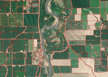
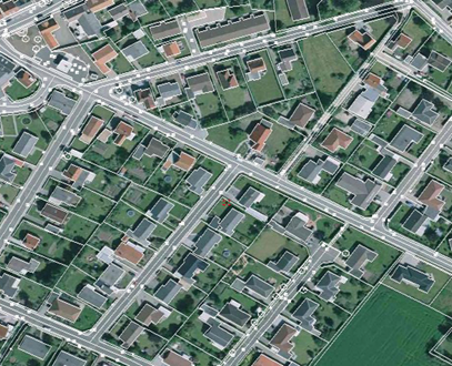
Apex Etech specialises in professional 2D geo-data conversion, transforming maps, technical drawings, satellite imagery, scanned documents, and engineering records into precise, GIS-ready datasets.
Our raster-to-vector conversion outsourcing workflows cover complete feature extraction, geometry-based vectorisation, CAD-to-GIS migration, topology refinement, and cadastral data digitisation — supporting dependable planning and operational workflows for utilities, infrastructure, and land administration.
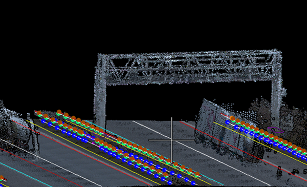
Apex provides specialized 3D vector services that convert spatial data into precise, structured 3D models using GIS, CAD, LiDAR, and photogrammetry sources. These datasets assist infrastructure planning, digital twins, and engineering operations.
We transform complex spatial information into refined 3D outputs that improve visualization, support deeper analysis, and guide informed decisions across urban, utility, and environmental projects.
Apex provides end-to-end cartography services for global clients, combining geospatial expertise with quality map design and visualization. Our services include data preparation, database structuring, styling, labeling, and delivery of publication-ready maps. We also create tailored solutions such as regional database adaptation, wall maps, fold maps, and thematic atlases.
Our focus is on converting complex spatial datasets into clear, structured, and visually effective maps for communication, analysis, and informed decisions.
")
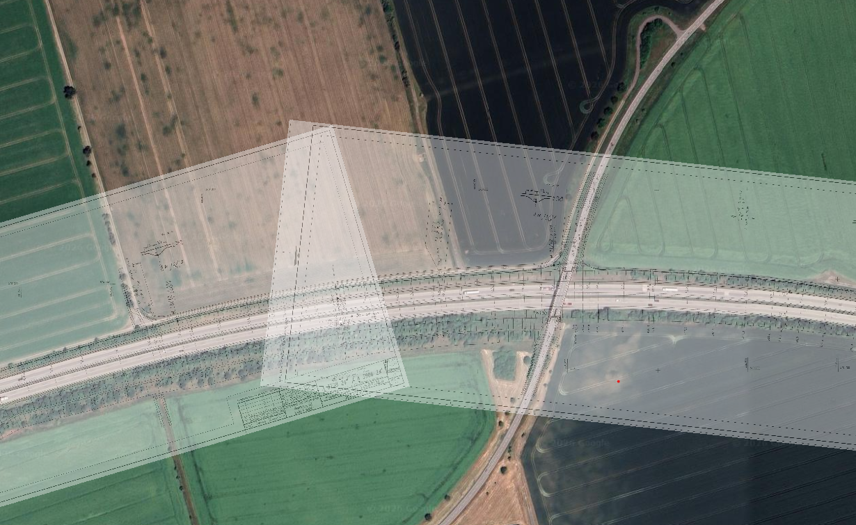
Apex provides specialized georeferencing and geocoding services that precisely connect spatial data with real-world coordinate systems. Our solutions support smooth integration of raster, vector, and address-based datasets within GIS platforms, enabling accurate mapping, spatial analysis, and infrastructure workflows.
Our services ensure that legacy maps, imagery, and location-based records are properly aligned, organized, and transformed into usable geospatial information for enterprise and engineering workflows.
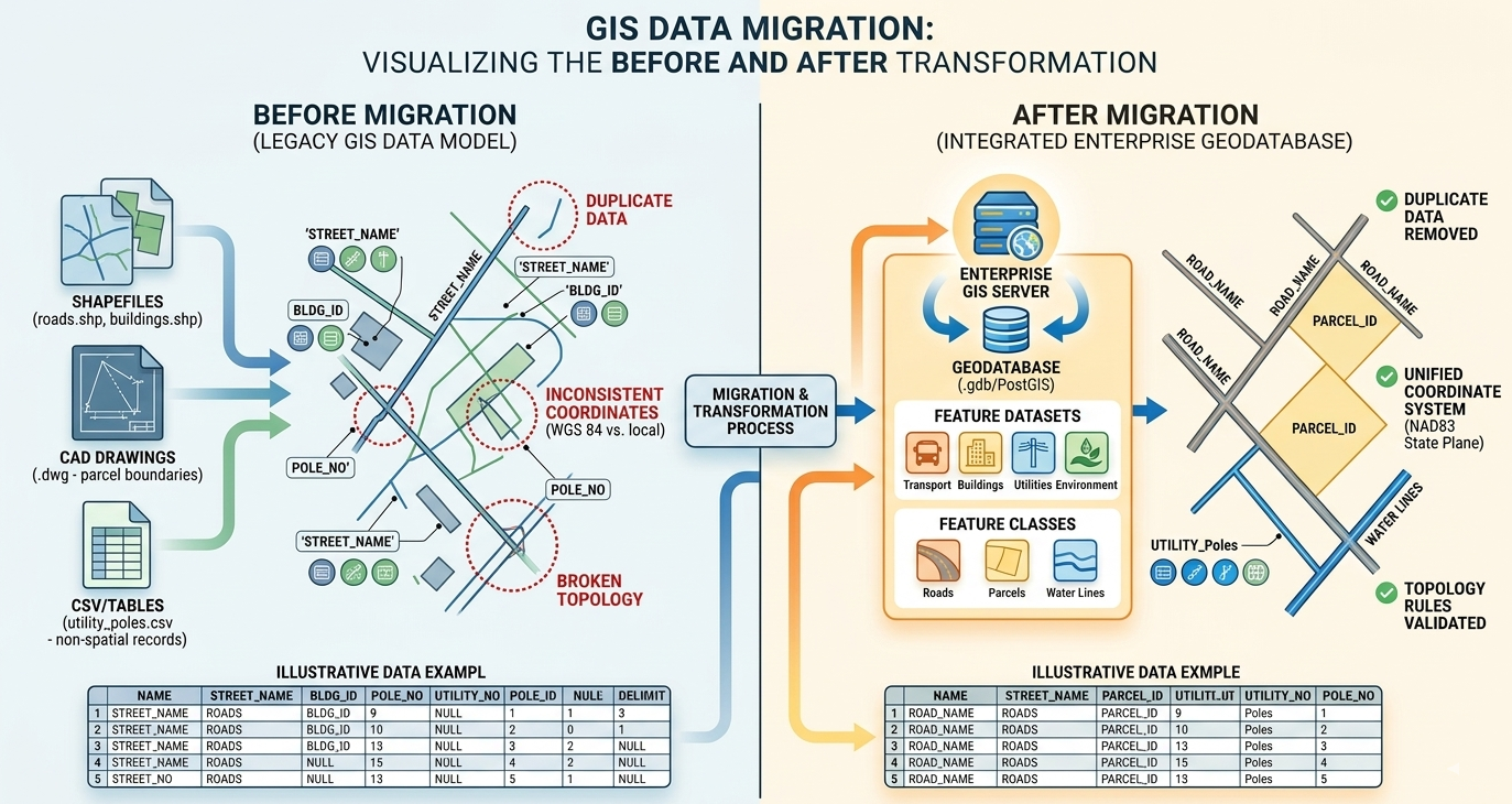
We assist geospatial data transfer projects through post-migration reviews, validation, and manual corrections to maintain data precision, consistency, and compliance with standards. Our focus is on reviewing migrated datasets within GIS platforms and resolving issues related to geometry, attributes, and data integrity.