A global geospatial solutions company delivering scalable BIM, LiDAR, and engineering data services across international markets.
From Experience to Global Impact
Every team member contributes a unique area of expertise, together enhancing the overall quality of our services.
Our methodology is grounded in teamwork, mutual respect, and a strong dedication
At Apex, our capabilities are driven by a multidisciplinary team with strong technical depth and execution focus. Each professional contributes domain expertise, enabling consistent delivery of high-quality outputs across diverse projects.
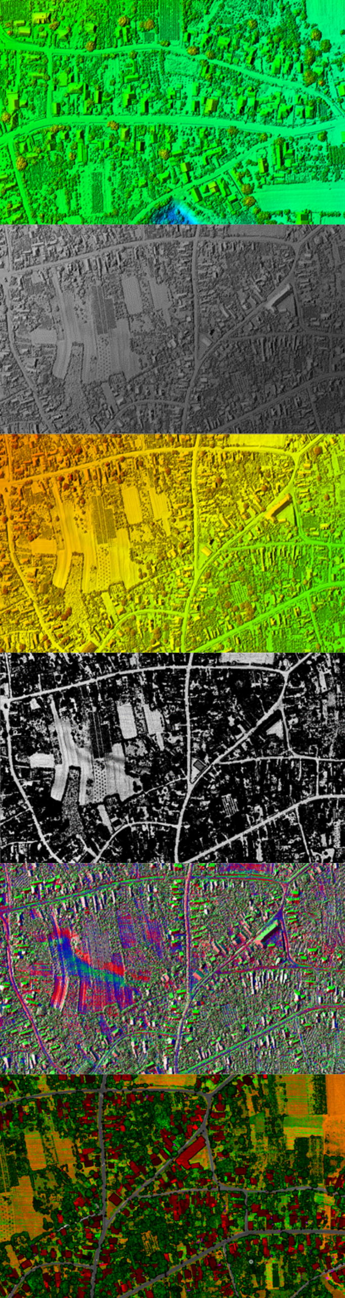
Our GIS team focuses on spatial data interpretation, converting large and complex datasets into structured information that supports planning, analysis, and decision-making processes.
Our CAD specialists develop accurate and standards-compliant technical drawings, ensuring that every design output meets required specifications and project expectations.
Our architectural team integrates design concepts with technical execution, producing built environment solutions that balance functionality with visual quality.
Our urban planning experts bring insight into spatial development and sustainability, supporting efficient data structuring and rapid understanding of project requirements.
Our photogrammetry team works with high-resolution imagery to generate precise spatial outputs, including 2D deliverables and 3D representations used in mapping and analysis.
Our LiDAR professionals process advanced point cloud data to produce detailed terrain models and spatial datasets, supporting infrastructure and environmental applications.
Our BIM and visualization team integrates multi-source data into coordinated digital models and creates visual outputs that clearly communicate project outcomes.
The foundation of Apex is built on leadership with extensive exposure to both local and international business environments. With over 15 years of cross-industry experience, the company was established to unify technical expertise and deliver advanced geospatial and engineering services. We actively promote a culture focused on precision, teamwork, and accountability, ensuring that every project meets rigorous quality standards.
Apex is further strengthened by a group of international advisors based in Germany, India, and the United States, who contribute strategic perspective and domain expertise. Their professional backgrounds span Architecture, Urban Planning, Geoinformatics, Energy, Mobility, and Natural Sciences, enabling informed decision-making and innovation. Their guidance supports our long-term direction and ensures alignment with evolving industry expectations.
At Apex, we follow a process-driven approach to project delivery, supported by close team coordination and a strong emphasis on quality. Our execution methods are continuously refined to align with specific project requirements, ensuring consistent, efficient, and reliable results.

We initiate every project with a comprehensive consultation to define needs, schedule, and scope, enabling effective team allocation.
We design a project-specific plan informed by initial insights, clearly detailing scope, milestones, and the technologies to be implemented.
We use advanced technologies to support collaboration, allowing real-time inputs and iterative improvements for efficient project execution.
The agile process we follow allows continuous adaptability, ensuring we can respond to changes and incorporate fresh information effectively..
We maintain quality through strict reviews and testing at each phase, from initial design through to final delivery.
We enable the incorporation of BIM models into operational workflows and provide hands-on training for successful implementation.
We ensure sustained support to keep systems performing efficiently and to manage updates or troubleshoot issues as needed.
We ensure eco-conscious decision-making by integrating considerations of materials, resources, and processes into every project.
Explore our comprehensive range of services designed to ensure high quality and efficiency in geospatial and engineering data processing.
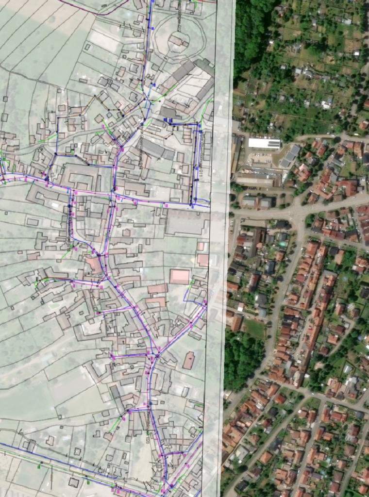
Documentation of cable and pipeline networks, transport infrastructure, cadastral mapping, and energy systems through precise GIS digitization and vector processing.
Advanced processing of spatial data including planimetric (2D) and topographic (3D) datasets, orthophotos, and analysis of sealed or built-up surfaces.
Processing and interpretation of LiDAR data for detailed infrastructure documentation including roads, highways, and bridges, along with enhanced classification and feature extraction.
Drone data processing including object inspection, volumetric analysis, object extraction, and generation of terrain models such as DTM (Digital Terrain Model).
Thematic mapping, object detection, change analysis, and generation of elevation models such as DEM, DSM, and DTM for environmental and infrastructure applications.
Development of As-Built 3D models, digital twins for infrastructure systems, 3D object reconstruction, and modeling of utility networks.
Machine learning-based feature extraction, change detection, error identification, data harmonization, and quality validation of geospatial datasets.
Georeferencing, geocoding, spatial orientation, coordinate transformation, and integration of geospatial data into CRM and ERP systems.
Integration of GIS data with business analytics, supply chain insights, real estate applications, and risk assessment models for decision-making
Want to understand how we work and deliver projects?
Here are some common questions from our clients.
We maintain strict confidentiality standards, secure data access procedures, and protection protocols to ensure complete security of all project information.
Contact our team at info@apexetech.com to share your requirements, and we will promptly recommend the right resource, workflow, and a cost-efficient solution tailored to your project.
We utilize secure data transfer methods, encrypted communication systems, and client-specific platforms to ensure safe and efficient information exchange.
We combine advanced geospatial engineering, data intelligence, and domain expertise to deliver accurate, efficient, and reliable solutions. Every project is executed with a strong focus on quality, precision, and real-world impact.
A certified team skilled in GIS, BIM, remote sensing, and spatial data engineering.
Delivering success through precision, expertise, and client focused solutions.
We deliver dependable geospatial services with accuracy, efficiency, and expertise tailored to your project requirements.
Our team remains available 24/7 to provide continuous support and ensure smooth project execution whenever required.