
Transportation and mobility ecosystems depend on dependable spatial data to enable autonomous systems, infrastructure planning, asset control, and efficient operations across roadways, rail systems, and urban mobility networks.
We convert complex geospatial and mobility datasets into meaningful insights that support smarter planning and more effective decision-making. By organizing road networks, asset information, and real-world conditions, we enhance visibility, improve predictability, and enable early risk identification.
This helps organizations make confident, data-driven decisions across transportation infrastructure and mobility systems.
We deliver organized, reliable, and continuously maintained datasets that enhance workflows across planning, maintenance, and operational activities.
Through improved data consistency and seamless system connectivity, we help organizations increase efficiency and reduce the complexity of managing transportation infrastructure.
We enhance routing efficiency and mobility planning by creating detailed representations of road geometry, traffic zones, and network structures.
By documenting essential elements such as road markings, signage, and asset inventories, we enable more accurate routing strategies and better traffic flow evaluation. This supports reduced travel times, improved network utilization, and the advancement of smart mobility systems in complex environments.
Our 3D modeling and high-definition mapping capabilities strengthen navigation intelligence and operational safety. By organizing detailed road geometry, condition insights, and real-world updates into structured data environments, we support use cases such as autonomous vehicles and driver assistance technologies. This improves awareness of surroundings, lowers operational risks, and increases safety for both network operators and end users.
Transportation organizations rely on Apex for integrated geospatial engineering solutions that digitize road and rail infrastructure, enhance asset performance, and support efficient, data-driven mobility ecosystems.
Transformation of road, highway, and rail datasets into structured GIS formats
Comprehensive mapping of roadside assets and supporting infrastructure components
Derivation of road markings, traffic signs, and mobility-related features
Development, refinement, and verification of HD maps for navigation and autonomous systems
Generation of precise 3D models for roads and associated infrastructure
Evaluation of road conditions and analysis of assets within roadway environments
Our delivery approach combines spatial data processing, digital modeling, and analytics to support comprehensive infrastructure transformation programs.
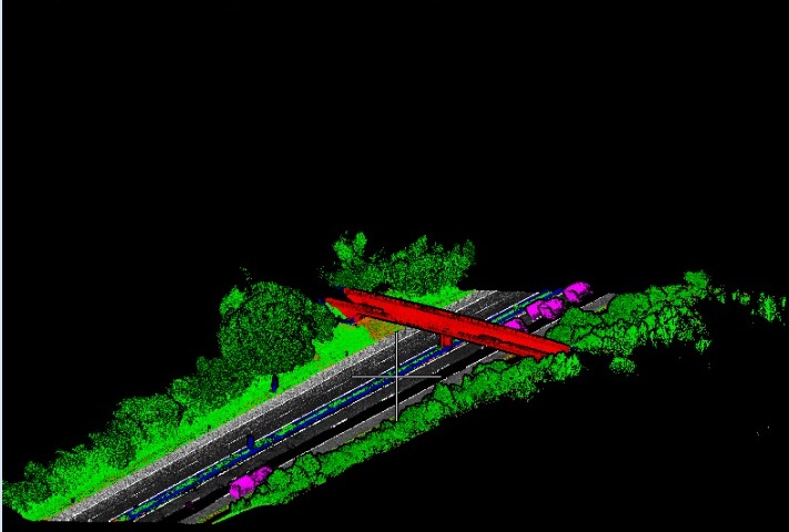

Reviewing multi-source road, rail, LiDAR, and imagery datasets.

Capturingroad geometry, traffic markings, signage, and asset information.

Creating 3D models and integrating transport datasets from multiple sources.

Maintaining data accuracy, consistency, and assessing network conditions.

Providing structured datasets that are continuously updated to reflect real-world changes.
Transportation organizations use Apex’s geospatial engineering solutions to build digital mobility networks, enhance infrastructure transparency, and improve operational performance across road, rail, and urban transport systems.
Faster capture and structuring of transport network data supporting rapid road and rail digitization.
High-definition mapping and asset extraction supporting accurate monitoring of road and transportation infrastructure components.
Geospatial analysis and digital modeling enabling optimized route design and informed infrastructure investment planning.
Precise datasets and condition modeling enabling safer travel and reduced risks across transport networks.
Work with our geospatial engineering specialists to modernize transportation systems, improve infrastructure transparency, and enable data-driven planning across road, rail, and mobility networks.